
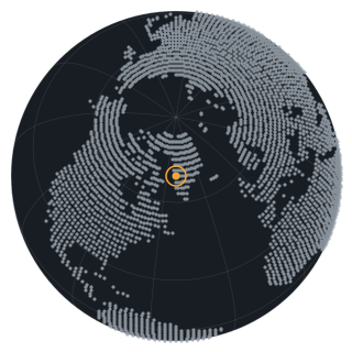
Ilulissat Icefjord and Disko Bay, Greenland, August 2024 to October 2025
Thirty-eight Sentinel-1 passes at a twelve-day interval record the icefjord's discharge, the freeze and break-up of Disko Bay, and the seasonal advance and retreat of sea ice over fifteen months.

- Place
- Ilulissat Icefjord and Disko Bay, Greenland
- Coordinates
- 69.2000, -51.1000
- Acquired
- 2024-08-10 and 2025-10-28
- Region
- Greenland, Avannaata
- Themes
- Ice and snow, Coasts
- Satellite
- Sentinel-1, radar
- Source
- Sentinel-1A interferometric wide swath, ground-range detected, HH polarisation, relative orbit 127
- Catalog
- Microsoft Planetary Computer STAC, collection sentinel-1-grd
- Resolution
- 40 m ground sample distance
- Scenes
S1A_IW_GRDH_1SDH_20240810T095231_20240810T095256_055149_06B88D,S1A_IW_GRDH_1SDH_20251028T095223_20251028T095248_061624_07B2C5- Rights
- Contains modified Copernicus Sentinel data 2024, 2025. Copernicus Sentinel data is free, full, and open. Rendering by Heimdall Research.
- Credit
- Contains modified Copernicus Sentinel data 2024, 2025.
- Published
Context
What this shows
Sermeq Kujalleq, the glacier behind Ilulissat Icefjord, is one of the fastest-moving glaciers in the world and a UNESCO World Heritage site. Its icebergs drift out through the fjord into Disko Bay, where they meet the seasonal sea ice. Radar sees this in any weather and through the polar night, so a twelve-day sequence holds together across the whole year.
The loop runs from 2024-08-10 to 2025-10-28: 38 passes. Bright is rough ice and land; dark is calm open water. Watch the bay freeze in winter, break up in spring, and the fjord push icebergs out through the summer.
Method
How the image was made
Every Sentinel-1A pass on relative orbit 127 between the two dates, warped to a common 40-meter grid, normalised on stable land pixels so wind and snow do not flicker, and shown with one shared brightness stretch. Each pass holds for under half a second and crossfades into the next. The scene identifiers for all 38 passes are in the machine-readable record for this observation.
Related
Related
-
Diomede Islands, Bering Strait, November 2024 and March 2025
Two radar acquisitions of the same 48 by 27 km window, 108 days apart, record the strait's transition from open water in November to fractured pack ice in March.
This observation
Prints and analysis
Prints are quoted once rights and source resolution are confirmed. Analysis requests get a direct answer about what the imagery can and cannot show.