
Gemini Solar, Clark County, Nevada, April 2020 and May 2024
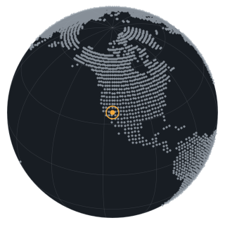
The same 20 by 11 km frame in 2020 and 2024 records the construction of a 690-megawatt solar plant on open desert northeast of Las Vegas.

2020-04-15

2024-05-24
- Place
- Gemini Solar, Clark County, Nevada, United States
- Coordinates
- 36.4492, -114.7619
- Acquired
- 2020-04-15 and 2024-05-24
- Region
- United States, Nevada
- Satellite
- Sentinel-2, true color
- Source
- Sentinel-2A Level-2A true-color image, 10 m, relative orbit 127, tiles T11SQA and T11SPA
- Catalog
- Microsoft Planetary Computer STAC, collection sentinel-2-l2a
- Resolution
- 10 m ground sample distance
- Scenes
S2A_MSIL2A_20200415T181921_R127_T11SQA,S2A_MSIL2A_20200415T181921_R127_T11SPA,S2A_MSIL2A_20240524T181921_R127_T11SQA,S2A_MSIL2A_20240524T181921_R127_T11SPA- Rights
- Contains modified Copernicus Sentinel data 2020, 2024. Copernicus Sentinel data is free, full, and open. Rendering by Heimdall Research.
- Credit
- Contains modified Copernicus Sentinel data 2020, 2024.
- Published
Context
What this shows
Gemini Solar sits on Bureau of Land Management land in the Moapa Valley area, about 40 km northeast of Las Vegas. The USGS solar facility database lists it at 690 megawatts, online in 2024, with a footprint of about 19 square kilometers. In the 2020 frame the site is desert cut by dry washes, with a highway on the left and a small settlement at the top. In the 2024 frame the panel blocks fill the center of the frame, and the washes inside the footprint are gone.
The same site is used as the worked example for change detection and construction updates on the Services page, where a Sentinel-1 radar pair and a three-year optical strip show the build in more detail.
Method
How the image was made
Two Sentinel-2A true-color scenes from the same relative orbit, four years apart, warped to a common 12.5-meter grid over a 20 by 11 km window and mosaicked from the two tiles that cover it. Both frames carry the same brightness and contrast adjustment so they compare directly. No classification is applied; the plant outline is not drawn here.
Prints
Prints
Every print carries the place, the date, and the source credit on the mat, as shown. Sizes and paper are quoted with the rights and source resolution confirmed.


This observation
Prints and analysis
Prints are quoted once rights and source resolution are confirmed. Analysis requests get a direct answer about what the imagery can and cannot show.